| Item Detail |
| |
| |
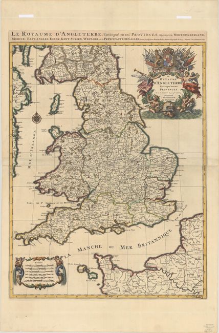
MapMaker: |
Sanson/Jaillot
|
|
| |
| |
Subject: |
England & Wales |
|
| |
Period/Size: |
1693 / 29.6" x 22.9" (75.2 x 58.2 cm)
|
|
| |
Color: |
Colored
|
|
| |
Condition: |
(A) A dark impression with attractive later color and minor soiling along the joint. There are horizontal creases in the wide margins at top and bottom, well away from image, and remnants of hinge tape on recto at top. (condition help) |
|
| |
Source: |
Atlas Nouveau... |
|
| |
References: |
Shirley (BI to 1750) Jaillot #2, state 1; Pastoureau, JAILLOT I D #82. |
|
| |
|
|
| Sales Information |
| |
| |
Price: |
|
|
| |
| |
Offered by: |
Old World Auctions |
|
| |
Catalog: |
Auction No. 193 - Antique Maps, Charts, Atlases & Globes (9567) |
|
| |
Lot/Item #: |
418 |
|
| |
| |
Date: |
07/2023
|
|
| |
| |
|