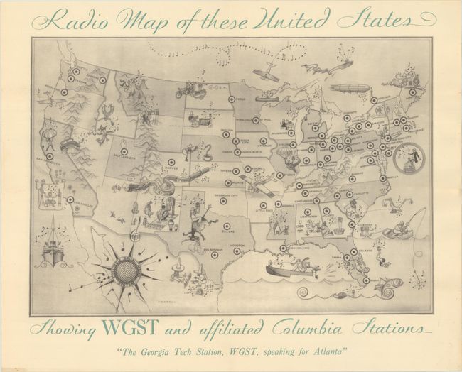
Title:
“Radio Map of These United States Showing WGST and Affiliated Columbia Stations”
Map Maker:
Charles Henry Forbell
This pictorial map was issued by the Columbia Broa... (full text available to subscribers)
| Item Detail |
| |
| |
MapMaker: |
Charles Henry Forbell
|
|
| |
| |
Subject: |
United States |
|
| |
Period/Size: |
1930 / 10.4" x 15.0" (26.5 x 38.1 cm)
|
|
| |
Color: |
Black & White
|
|
| |
Condition: |
(A) Issued folding with a few spots of foxing in the blank margins. (condition help) |
|
| |
Source: |
|
|
| |
References: |
cf. Rumsey #9116. |
|
| |
|
|
| Sales Information |
| |
| |
Price: |
|
|
| |
| |
Offered by: |
Old World Auctions |
|
| |
Catalog: |
Auction No. 193 - Antique Maps, Charts, Atlases & Globes (9567) |
|
| |
Lot/Item #: |
144 |
|
| |
| |
Date: |
07/2023
|
|
| |
| |
|
Antique Maps - Valuation and Pricing, Descriptions, Resources |
|
Home |
Information |
Search |
Register |
Contact Us |
Site Map
Americana Exchange, Inc. © 1999 - 2024 Americana Exchange, Inc.. All rights reserved.
OldMaps.com, the OldMaps.com logo and
AMPR are service marks or registered service marks of Americana Exchange, Inc..
|