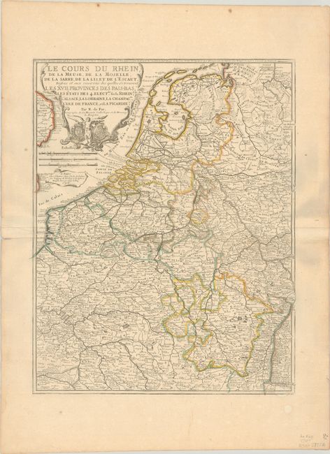
Title:
“Le Cours du Rhein, de la Meuse, de la Moselle, de la Sarre, de la Lis, et de l'Escaut...”
Map Maker:
Nicholas de Fer
This map focuses on the region surrounding the maj... (full text available to subscribers)
| Item Detail |
| |
| |
MapMaker: |
Nicholas de Fer
|
|
| |
| |
Subject: |
Western Europe, Rivers |
|
| |
Period/Size: |
1705 / 22.0" x 17.2" (55.9 x 43.7 cm)
|
|
| |
Color: |
Colored
|
|
| |
Condition: |
(B+) Contemporary outline color on a sturdy sheet with the watermark of a Maltese cross encircled in rosary beads. There is a hint of toning, a printer's crease at left, some extraneous creasing adjacent to the centerfold, and a tear that enters less tha (condition help) |
|
| |
Source: |
|
|
| |
References: |
|
|
| |
|
|
| Sales Information |
| |
| |
Price: |
|
|
| |
| |
Offered by: |
Old World Auctions |
|
| |
Catalog: |
Auction No. 193 - Antique Maps, Charts, Atlases & Globes (9567) |
|
| |
Lot/Item #: |
465 |
|
| |
| |
Date: |
07/2023
|
|
| |
| |
|
Antique Maps - Valuation and Pricing, Descriptions, Resources |
|
Home |
Information |
Search |
Register |
Contact Us |
Site Map
Americana Exchange, Inc. © 1999 - 2024 Americana Exchange, Inc.. All rights reserved.
OldMaps.com, the OldMaps.com logo and
AMPR are service marks or registered service marks of Americana Exchange, Inc..
|