Title:
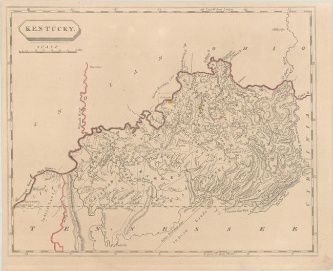
“Kentucky”
Map Maker:
Aaron Arrowsmith & Samuel Lewis
This county map shows towns, early roads, rivers, ... (full text available to subscribers)
| Item Detail |
| |
| |
MapMaker: |
Aaron Arrowsmith & Samuel Lewis
|
|
| |
| |
Subject: |
Kentucky |
|
| |
Period/Size: |
1812 / 8.0" x 9.9" (20.4 x 25.2 cm)
|
|
| |
Color: |
Colored
|
|
| |
Condition: |
(B+) On a lightly toned sheet with an old "Forbes Library" stamp on verso. (condition help) |
|
| |
Source: |
A New and Elegant General Atlas |
|
| |
References: |
|
|
| |
|
|
| Sales Information |
| |
| |
Price: |
|
|
| |
| |
Offered by: |
Old World Auctions |
|
| |
Catalog: |
Auction No. 193 - Antique Maps, Charts, Atlases & Globes (9567) |
|
| |
Lot/Item #: |
259 |
|
| |
| |
Date: |
07/2023
|
|
| |
| |
|
Antique Maps - Valuation and Pricing, Descriptions, Resources |
|
Home |
Information |
Search |
Register |
Contact Us |
Site Map
Americana Exchange, Inc. © 1999 - 2024 Americana Exchange, Inc.. All rights reserved.
OldMaps.com, the OldMaps.com logo and
AMPR are service marks or registered service marks of Americana Exchange, Inc..
|