Title:
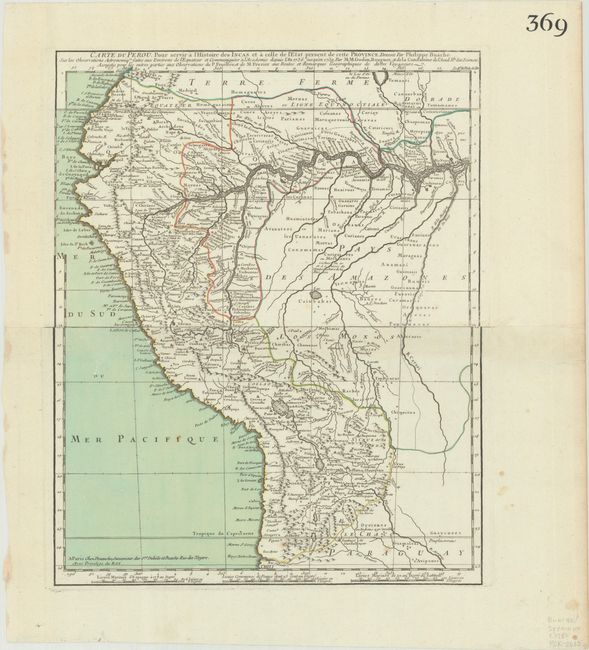
“Carte du Perou, pour Servir a l'Histoire des Incas et a Celle de l'Etat Present de Cette Province...”
Map Maker:
Buache/Dezauche
This map focuses on present-day Peru and Ecuador, ... (full text available to subscribers)
| Item Detail |
| |
| |
MapMaker: |
Buache/Dezauche
|
|
| |
| |
Subject: |
Western South America, Peru |
|
| |
Period/Size: |
1780 / 15.1" x 12.1" (38.4 x 30.8 cm)
|
|
| |
Color: |
Colored
|
|
| |
Condition: |
(A) A crisp impression with full contemporary color on bright sheets with bunch of grapes watermarks, very minor soiling in the image, and several small stains in the blank margins. (condition help) |
|
| |
Source: |
|
|
| |
References: |
|
|
| |
|
|
| Sales Information |
| |
| |
Price: |
|
|
| |
| |
Offered by: |
Old World Auctions |
|
| |
Catalog: |
Auction No. 193 - Antique Maps, Charts, Atlases & Globes (9567) |
|
| |
Lot/Item #: |
372 |
|
| |
| |
Date: |
07/2023
|
|
| |
| |
|
Antique Maps - Valuation and Pricing, Descriptions, Resources |
|
Home |
Information |
Search |
Register |
Contact Us |
Site Map
Americana Exchange, Inc. © 1999 - 2024 Americana Exchange, Inc.. All rights reserved.
OldMaps.com, the OldMaps.com logo and
AMPR are service marks or registered service marks of Americana Exchange, Inc..
|