Title:
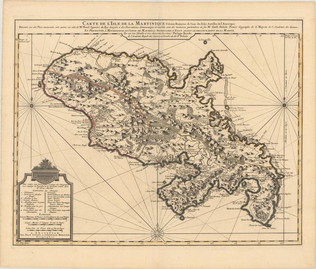
“Carte de l'Isle de la Martinique Colonie Francoise de l'une des Isles Antilles de l'Amerique...”
Map Maker:
Delisle/Covens & Mortier
A large chart of the island engraved to show mount... (full text available to subscribers)
| Item Detail |
| |
| |
MapMaker: |
Delisle/Covens & Mortier
|
|
| |
| |
Subject: |
Martinique |
|
| |
Period/Size: |
1730 / 18.1" x 23.3" (46.0 x 59.2 cm)
|
|
| |
Color: |
Colored
|
|
| |
Condition: |
(A) A superb, dark impression with contemporary outline color on a sturdy sheet with a "C&I Honig" watermark and a hint of offsetting. (condition help) |
|
| |
Source: |
|
|
| |
References: |
|
|
| |
|
|
| Sales Information |
| |
| |
Price: |
|
|
| |
| |
Offered by: |
Old World Auctions |
|
| |
Catalog: |
Auction No. 193 - Antique Maps, Charts, Atlases & Globes (9567) |
|
| |
Lot/Item #: |
346 |
|
| |
| |
Date: |
07/2023
|
|
| |
| |
|
Antique Maps - Valuation and Pricing, Descriptions, Resources |
|
Home |
Information |
Search |
Register |
Contact Us |
Site Map
Americana Exchange, Inc. © 1999 - 2024 Americana Exchange, Inc.. All rights reserved.
OldMaps.com, the OldMaps.com logo and
AMPR are service marks or registered service marks of Americana Exchange, Inc..
|