Title:
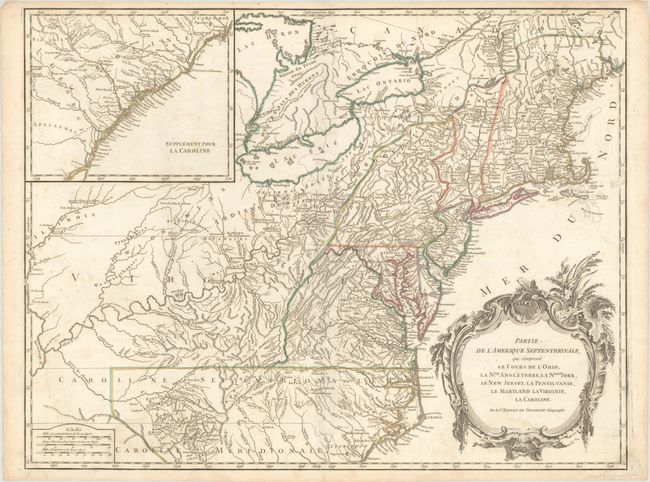
“Partie de l'Amerique Septentrionale, qui Comprend le Cours de l'Ohio, la Nlle. Angleterre, la Nlle York, le New Jersey, la Pensylvanie, le Maryland la Virginie, la Caroline”
Map Maker:
Didier Robert de Vaugondy
Beautifully engraved large map of the colonies bet... (full text available to subscribers)
| Item Detail |
| |
| |
MapMaker: |
Didier Robert de Vaugondy
|
|
| |
| |
Subject: |
Colonial New England & Mid-Atlantic United States |
|
| |
Period/Size: |
1768 / 19.0" x 24.7" (48.3 x 62.8 cm)
|
|
| |
Color: |
Colored
|
|
| |
Condition: |
(B+) Contemporary outline color on a bright sheet with a "P[heart]Serve l'Arsenal" watermark. There is very light soiling, a tiny paper flaw in South Carolina, a minor centerfold separation at bottom, and some faint dampstaining along the bottom of the s (condition help) |
|
| |
Source: |
Atlas Universel |
|
| |
References: |
Cumming (SE) #295; McCorkle #755-37; Pedley #469; Sellers & Van Ee #718. |
|
| |
|
|
| Sales Information |
| |
| |
Price: |
|
|
| |
| |
Offered by: |
Old World Auctions |
|
| |
Catalog: |
Auction No. 193 - Antique Maps, Charts, Atlases & Globes (9567) |
|
| |
Lot/Item #: |
167 |
|
| |
| |
Date: |
07/2023
|
|
| |
| |
|
Antique Maps - Valuation and Pricing, Descriptions, Resources |
|
Home |
Information |
Search |
Register |
Contact Us |
Site Map
Americana Exchange, Inc. © 1999 - 2024 Americana Exchange, Inc.. All rights reserved.
OldMaps.com, the OldMaps.com logo and
AMPR are service marks or registered service marks of Americana Exchange, Inc..
|