Rister or Sign In to see pricing information


Title:

Silesiae Ducatus Accurata et Vera Delineatio...

Map Maker:

Henricus Hondius

Silesiae Ducatus Accurata et Vera Delineatio...

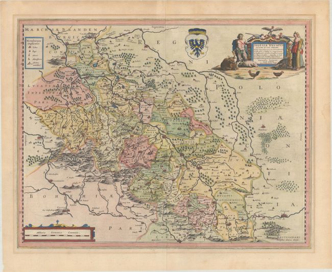
This map is centered approximately on Breslaw
Item Detail
 
  MapMaker:  

Henricus Hondius


  Subject:  Southwestern Poland  
  Period/Size:  1636 / 15.3" x 19.4"  (38.9 x 49.3 cm)  
  Color:  Colored  
  Condition:  (A) A crisp impression on a watermarked sheet with light mat burn outside the image and a few minor dampstains along the edges of the sheet. (condition help)  
  Source:  A Geographicke Description of the Regions, Countries and Kingdomes of the World  
  References:  Van der Krogt (Vol. I) #2900:1C.1.  
 
 
Sales Information
 
  Price: 

Please register your email to view records, or sign in with email address to see records


  Offered by:  Old World Auctions  
  Catalog:  Auction No. 193 - Antique Maps, Charts, Atlases & Globes (9567)  
  Lot/Item #:  527  
 
  Date:  07/2023  


Antique Maps - Valuation and Pricing, Descriptions, Resources


Home | Information | Search | Register | Contact Us | Site Map

Americana Exchange, Inc. © 1999 - 2024 Americana Exchange, Inc.. All rights reserved. OldMaps.com, the OldMaps.com logo and
AMPR are service marks or registered service marks of Americana Exchange, Inc..