| Item Detail |
| |
| |
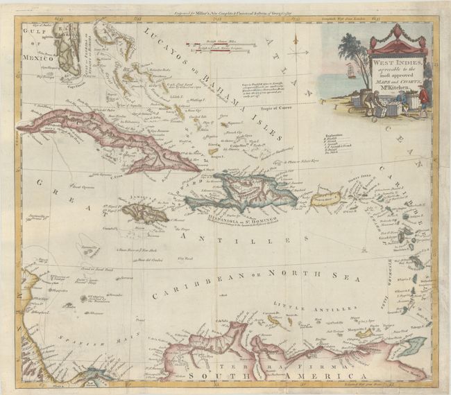
MapMaker: |
Thomas Kitchin
|
|
| |
| |
Subject: |
Caribbean |
|
| |
Period/Size: |
1782 / 13.3" x 15.0" (33.8 x 38.1 cm)
|
|
| |
Color: |
Colored
|
|
| |
Condition: |
(B+) Issued folding, now flat, with extraneous creasing and a couple archivally repaired edge tears at right that enter approximately 1.5" into map image. (condition help) |
|
| |
Source: |
Millar's New Complete & Universal System of Geography |
|
| |
References: |
McCorkle (18th C. Geography Books) #281 [28]. |
|
| |
|
|
| Sales Information |
| |
| |
Price: |
|
|
| |
| |
Offered by: |
Old World Auctions |
|
| |
Catalog: |
Auction No. 193 - Antique Maps, Charts, Atlases & Globes (9567) |
|
| |
Lot/Item #: |
332 |
|
| |
| |
Date: |
07/2023
|
|
| |
| |
|