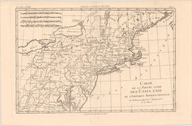
Title:
“Carte de la Partie Nord des Etats Unis de l'Amerique Septentrionale”
Map Maker:
Rigobert Bonne
This very early map presents the northern part of ... (full text available to subscribers)
| Item Detail |
| |
| |
MapMaker: |
Rigobert Bonne
|
|
| |
| |
Subject: |
Colonial New England & Mid-Atlantic United States |
|
| |
Period/Size: |
1780 / 8.1" x 12.4" (20.6 x 31.5 cm)
|
|
| |
Color: |
Black & White
|
|
| |
Condition: |
(B+) There are a couple of faint spots in the image. (condition help) |
|
| |
Source: |
Atlas de Toutes les Parties Connues du Globe Terrestre |
|
| |
References: |
McCorkle #782.1B; Sellers & van Ee #744. |
|
| |
|
|
| Sales Information |
| |
| |
Price: |
|
|
| |
| |
Offered by: |
Old World Auctions |
|
| |
Catalog: |
Auction No. 193 - Antique Maps, Charts, Atlases & Globes (9567) |
|
| |
Lot/Item #: |
168 |
|
| |
| |
Date: |
07/2023
|
|
| |
| |
|
Antique Maps - Valuation and Pricing, Descriptions, Resources |
|
Home |
Information |
Search |
Register |
Contact Us |
Site Map
Americana Exchange, Inc. © 1999 - 2024 Americana Exchange, Inc.. All rights reserved.
OldMaps.com, the OldMaps.com logo and
AMPR are service marks or registered service marks of Americana Exchange, Inc..
|