Title:
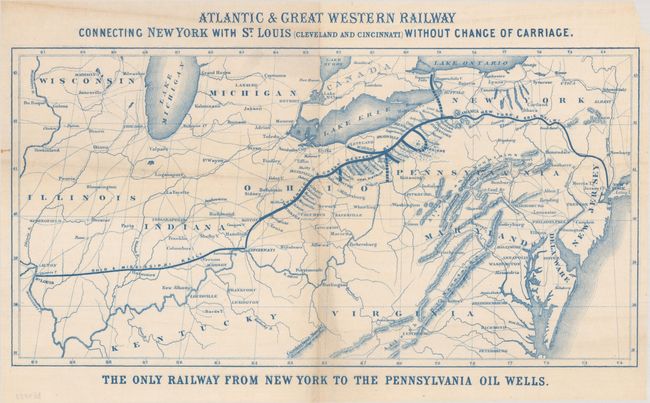
“Atlantic & Great Western Railway Connecting New York with St. Louis (Cleveland and Cincinnati) Without Change of Carriage”
Map Maker:
Railroad Companies (various)
This promotional map, printed in blue ink, shows t... (full text available to subscribers)
| Item Detail |
| |
| |
MapMaker: |
Railroad Companies (various)
|
|
| |
| |
Subject: |
Eastern United States |
|
| |
Period/Size: |
1865 / 8.4" x 16.4" (21.4 x 41.7 cm)
|
|
| |
Color: |
Colored
|
|
| |
Condition: |
(B+) There is a hint of toning along the centerfold, a couple of tiny tears and separations along the fold, and some minor extraneous creasing. A small chip is confined to the top right corner of the sheet. (condition help) |
|
| |
Source: |
|
|
| |
References: |
|
|
| |
|
|
| Sales Information |
| |
| |
Price: |
|
|
| |
| |
Offered by: |
Old World Auctions |
|
| |
Catalog: |
Auction No. 193 - Antique Maps, Charts, Atlases & Globes (9567) |
|
| |
Lot/Item #: |
160 |
|
| |
| |
Date: |
07/2023
|
|
| |
| |
|
Antique Maps - Valuation and Pricing, Descriptions, Resources |
|
Home |
Information |
Search |
Register |
Contact Us |
Site Map
Americana Exchange, Inc. © 1999 - 2024 Americana Exchange, Inc.. All rights reserved.
OldMaps.com, the OldMaps.com logo and
AMPR are service marks or registered service marks of Americana Exchange, Inc..
|