Title:
“A Voyage Round the World, in the Years MDCCXL, I, II, III, IV...”
Map Maker:
George Anson
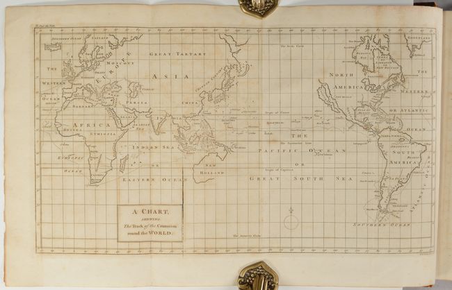
This is the ninth edition of Anson's work describi... (full text available to subscribers)
| Item Detail |
| |
| |
MapMaker: |
George Anson
|
|
| |
| |
Subject: |
Exploration & Surveys |
|
| |
Period/Size: |
1756 / 11.6" x 9.5" (29.5 x 24.2 cm)
|
|
| |
Color: |
Black & White
|
|
| |
Condition: |
() See description above for the four folding maps. The other plates are very good to near fine with light offsetting. Text is mostly clean with occasional offsetting. There is a bookplate for the Heytesbury House on the front pastedown. Hinges are st (condition help) |
|
| |
Source: |
|
|
| |
References: |
cf. Shirley (BL Atlases) G.ANS-1a; Mercator's World Nov/Dec 1998 pp. 45-51. |
|
| |
|
|
| Sales Information |
| |
| |
Price: |
|
|
| |
| |
Offered by: |
Old World Auctions |
|
| |
Catalog: |
Auction No. 193 - Antique Maps, Charts, Atlases & Globes (9567) |
|
| |
Lot/Item #: |
759 |
|
| |
| |
Date: |
07/2023
|
|
| |
| |
|
Antique Maps - Valuation and Pricing, Descriptions, Resources |
|
Home |
Information |
Search |
Register |
Contact Us |
Site Map
Americana Exchange, Inc. © 1999 - 2024 Americana Exchange, Inc.. All rights reserved.
OldMaps.com, the OldMaps.com logo and
AMPR are service marks or registered service marks of Americana Exchange, Inc..
|