Title:
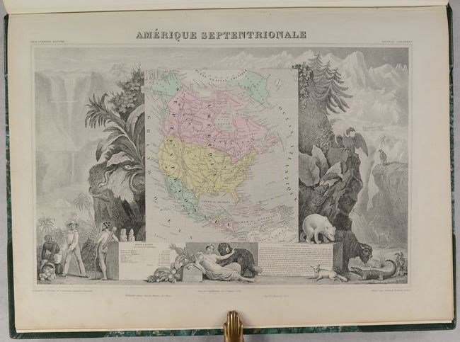
“Atlas National Illustre des 89 Departements et des Possessions de la France Divise par Arrondissements, Cantons et Communes...”
Map Maker:
Victor Levasseur
This was one of the last decorative atlases ever p... (full text available to subscribers)
| Item Detail |
| |
| |
MapMaker: |
Victor Levasseur
|
|
| |
| |
Subject: |
France, Atlases |
|
| |
Period/Size: |
1869 / 20.6" x 14.9" (52.4 x 37.9 cm)
|
|
| |
Color: |
Colored
|
|
| |
Condition: |
(A) Nearly all of the maps have excellent impressions with occasional minor marginal soiling or foxing. The first two maps (Ain and Aisne) are in good (B) condition with moderate soiling and an edge tear on the map of Ain. The map of Ain has trimmed mar (condition help) |
|
| |
Source: |
|
|
| |
References: |
|
|
| |
|
|
| Sales Information |
| |
| |
Price: |
|
|
| |
| |
Offered by: |
Old World Auctions |
|
| |
Catalog: |
Auction No. 193 - Antique Maps, Charts, Atlases & Globes (9567) |
|
| |
Lot/Item #: |
473 |
|
| |
| |
Date: |
07/2023
|
|
| |
| |
|
Antique Maps - Valuation and Pricing, Descriptions, Resources |
|
Home |
Information |
Search |
Register |
Contact Us |
Site Map
Americana Exchange, Inc. © 1999 - 2024 Americana Exchange, Inc.. All rights reserved.
OldMaps.com, the OldMaps.com logo and
AMPR are service marks or registered service marks of Americana Exchange, Inc..
|