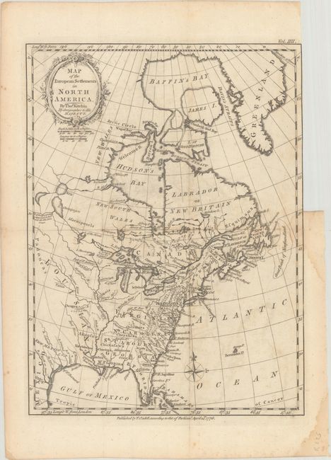
Title:
“Map of the European Settlements in North America”
Map Maker:
Thomas Kitchin
This map covers the eastern part of North America ... (full text available to subscribers)
| Item Detail |
| |
| |
MapMaker: |
Thomas Kitchin
|
|
| |
| |
Subject: |
Colonial Eastern United States & Canada |
|
| |
Period/Size: |
1776 / 12.8" x 9.5" (32.6 x 24.2 cm)
|
|
| |
Color: |
Black & White
|
|
| |
Condition: |
(B+) Issued folding with light offsetting and a dampstain at right that just enters the border. There is a binder's trim at upper right with a short binding tear that has been closed on verso with archival tape. (condition help) |
|
| |
Source: |
A Philosophical and Political History...in the East and West Indies |
|
| |
References: |
McCorkle #776.17; Sellers & van Ee #139. |
|
| |
|
|
| Sales Information |
| |
| |
Price: |
|
|
| |
| |
Offered by: |
Old World Auctions |
|
| |
Catalog: |
Auction No. 193 - Antique Maps, Charts, Atlases & Globes (9567) |
|
| |
Lot/Item #: |
118 |
|
| |
| |
Date: |
07/2023
|
|
| |
| |
|
Antique Maps - Valuation and Pricing, Descriptions, Resources |
|
Home |
Information |
Search |
Register |
Contact Us |
Site Map
Americana Exchange, Inc. © 1999 - 2024 Americana Exchange, Inc.. All rights reserved.
OldMaps.com, the OldMaps.com logo and
AMPR are service marks or registered service marks of Americana Exchange, Inc..
|