| Item Detail |
| |
| |
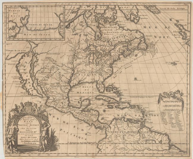
MapMaker: |
Fr. Louis de Hennepin
|
|
| |
| |
Subject: |
Colonial North America |
|
| |
Period/Size: |
1704 / 17.0" x 20.5" (43.2 x 52.1 cm)
|
|
| |
Color: |
Black & White
|
|
| |
Condition: |
(B) A dark impression, issued folding on a sheet with a small "C.B." watermark. There is minor toning, some tiny spots of foxing, and a few tiny separations along the folds. There is a binding trim at left that extends to the neatline, with partial loss (condition help) |
|
| |
Source: |
|
|
| |
References: |
Burden #738; Goss (NA) #47; McCorkle #697.2; McLauglin #124-2; Tooley p. 125 #59; Wagner (NW) #452. |
|
| |
|
|
| Sales Information |
| |
| |
Price: |
|
|
| |
| |
Offered by: |
Old World Auctions |
|
| |
Catalog: |
Auction No. 193 - Antique Maps, Charts, Atlases & Globes (9567) |
|
| |
Lot/Item #: |
87 |
|
| |
| |
Date: |
07/2023
|
|
| |
| |
|