| Item Detail |
| |
| |
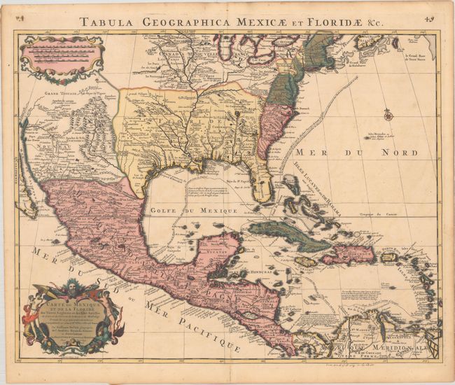
MapMaker: |
Delisle/Covens & Mortier
|
|
| |
| |
Subject: |
Colonial Eastern North America & West Indies |
|
| |
Period/Size: |
1722 / 18.5" x 23.8" (47.0 x 60.5 cm)
|
|
| |
Color: |
Colored
|
|
| |
Condition: |
(B+) A sharp impression with full contemporary color, a hint of offsetting, light soiling, and an archivally repaired centerfold separation at bottom. There are old manuscript ink notations in the bottom margin and in the top corners of the sheet. (condition help) |
|
| |
Source: |
|
|
| |
References: |
Tooley (Amer) #51; Schwartz & Ehrenberg, plt. 82; Martin & Martin plt.17; cf. Brown (IMCOS #165) pp. 37-39; cf. Cummings (SE) #137. |
|
| |
|
|
| Sales Information |
| |
| |
Price: |
|
|
| |
| |
Offered by: |
Old World Auctions |
|
| |
Catalog: |
Auction No. 193 - Antique Maps, Charts, Atlases & Globes (9567) |
|
| |
Lot/Item #: |
98 |
|
| |
| |
Date: |
07/2023
|
|
| |
| |
|