| Item Detail |
| |
| |
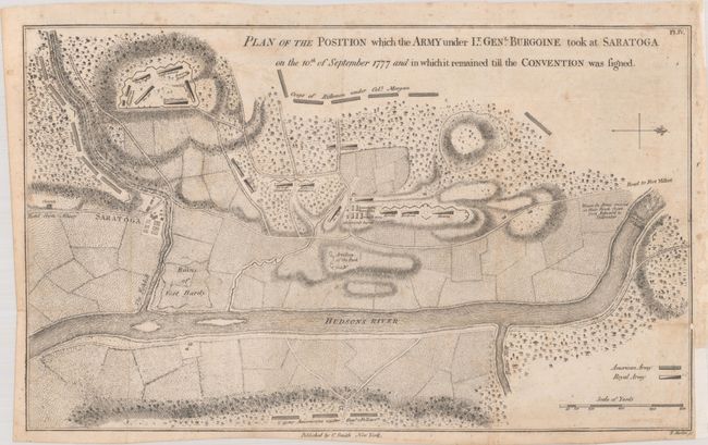
MapMaker: |
Charles Smith
|
|
| |
| |
Subject: |
Colonial Saratoga, New York, Revolutionary War |
|
| |
Period/Size: |
1796 / 8.4" x 13.8" (21.4 x 35.1 cm)
|
|
| |
Color: |
Black & White
|
|
| |
Condition: |
(B+) Issued folding, now flattened and backed in archival tissue, filling in the binding trim and repairing a short binding tear at bottom right. There is light soiling and foxing. (condition help) |
|
| |
Source: |
Monthly Military Repository |
|
| |
References: |
cf. Nebenzahl (American Revolution) #23; Wheat & Brun #374. |
|
| |
|
|
| Sales Information |
| |
| |
Price: |
|
|
| |
| |
Offered by: |
Old World Auctions |
|
| |
Catalog: |
Auction No. 193 - Antique Maps, Charts, Atlases & Globes (9567) |
|
| |
Lot/Item #: |
276 |
|
| |
| |
Date: |
07/2023
|
|
| |
| |
|