| Item Detail |
| |
| |
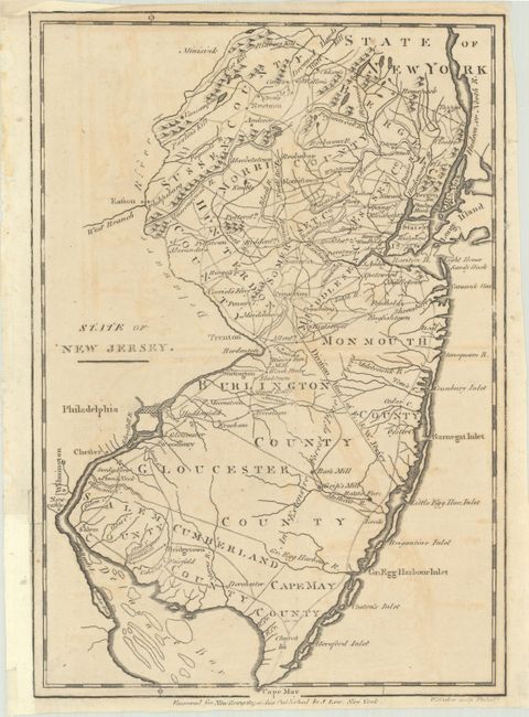
MapMaker: |
William Barker
|
|
| |
| |
Subject: |
New Jersey |
|
| |
Period/Size: |
1799 / 10.6" x 7.4" (27.0 x 18.8 cm)
|
|
| |
Color: |
Black & White
|
|
| |
Condition: |
(B+) Issued folding on a lightly toned sheet with light offsetting and small remnants of framing tape along the edges of the sheet on recto. There is a binding trim at bottom left that has been replaced with old paper and a short binding tear that has be (condition help) |
|
| |
Source: |
New Encyclopaedia |
|
| |
References: |
cf. Wheat & Brun #420. |
|
| |
|
|
| Sales Information |
| |
| |
Price: |
|
|
| |
| |
Offered by: |
Old World Auctions |
|
| |
Catalog: |
Auction No. 193 - Antique Maps, Charts, Atlases & Globes (9567) |
|
| |
Lot/Item #: |
269 |
|
| |
| |
Date: |
07/2023
|
|
| |
| |
|