| Item Detail |
| |
| |
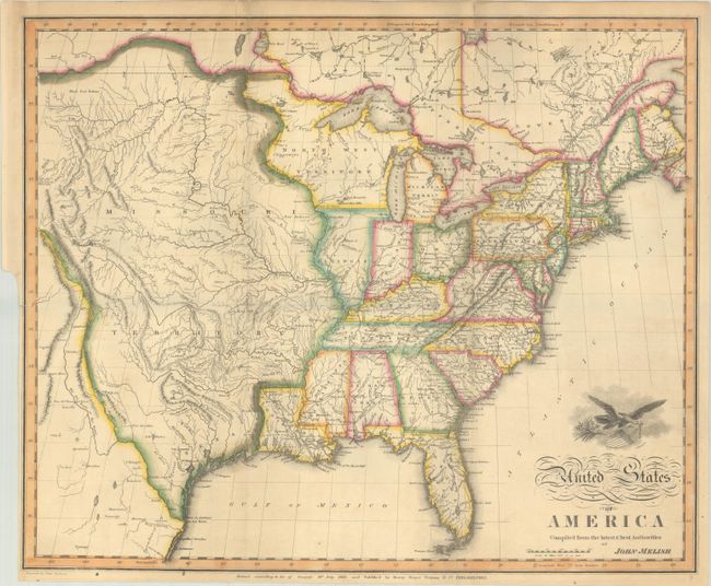
MapMaker: |
John Melish
|
|
| |
| |
Subject: |
Eastern United States |
|
| |
Period/Size: |
1818 / 16.3" x 19.7" (41.4 x 50.1 cm)
|
|
| |
Color: |
Colored
|
|
| |
Condition: |
(B+) Contemporary outline color on sturdy paper with an archivally repaired 0.5" fold separation at top left and minor creasing adjacent to the vertical folds. There is a binder's trim at lower left. Issued folding. (condition help) |
|
| |
Source: |
|
|
| |
References: |
Wheat (TMW) #327; Phillips (Maps) p. 880. |
|
| |
|
|
| Sales Information |
| |
| |
Price: |
|
|
| |
| |
Offered by: |
Old World Auctions |
|
| |
Catalog: |
Auction No. 193 - Antique Maps, Charts, Atlases & Globes (9567) |
|
| |
Lot/Item #: |
158 |
|
| |
| |
Date: |
07/2023
|
|
| |
| |
|