| Item Detail |
| |
| |
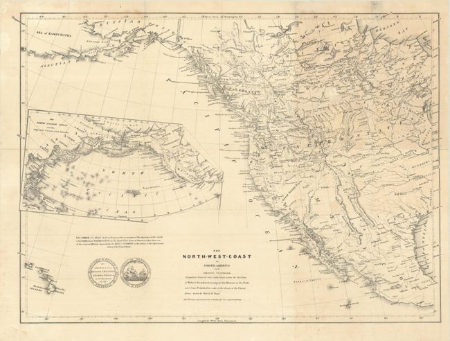
MapMaker: |
Robert Greenhow
|
|
| |
| |
Subject: |
Western North America |
|
| |
Period/Size: |
1840 / 16.1" x 22.3" (40.9 x 56.7 cm)
|
|
| |
Color: |
Black & White
|
|
| |
Condition: |
(B+) Issued folding with light toning and offsetting, a few small spots, and a professionally repaired binding tear that extends 2.5" into map image at right. (condition help) |
|
| |
Source: |
Greenhow's Memoir of the North West Coast |
|
| |
References: |
Phillips (Maps) p. 603; Wheat [TMW] #447. |
|
| |
|
|
| Sales Information |
| |
| |
Price: |
|
|
| |
| |
Offered by: |
Old World Auctions |
|
| |
Catalog: |
Auction No. 193 - Antique Maps, Charts, Atlases & Globes (9567) |
|
| |
Lot/Item #: |
100 |
|
| |
| |
Date: |
07/2023
|
|
| |
| |
|