Title:
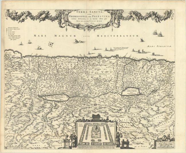
“Terra Sancta, sive Promissionis, olim Palestina Recens Delineata, et in Lucem Edita”
Map Maker:
Nicolas Visscher
North is oriented to the right on this richly deco... (full text available to subscribers)
| Item Detail |
| |
| |
MapMaker: |
Nicolas Visscher
|
|
| |
| |
Subject: |
Holy Land |
|
| |
Period/Size: |
1659 / 18.3" x 22.3" (46.5 x 56.7 cm)
|
|
| |
Color: |
Black & White
|
|
| |
Condition: |
(A) A sharp impression on a bright sheet, issued folding with some short fold separations at bottom center that have been repaired with old paper on verso, and soiling along the left edge of the sheet. (condition help) |
|
| |
Source: |
|
|
| |
References: |
Laor #793. |
|
| |
|
|
| Sales Information |
| |
| |
Price: |
|
|
| |
| |
Offered by: |
Old World Auctions |
|
| |
Catalog: |
Auction No. 193 - Antique Maps, Charts, Atlases & Globes (9567) |
|
| |
Lot/Item #: |
604 |
|
| |
| |
Date: |
07/2023
|
|
| |
| |
|
Antique Maps - Valuation and Pricing, Descriptions, Resources |
|
Home |
Information |
Search |
Register |
Contact Us |
Site Map
Americana Exchange, Inc. © 1999 - 2024 Americana Exchange, Inc.. All rights reserved.
OldMaps.com, the OldMaps.com logo and
AMPR are service marks or registered service marks of Americana Exchange, Inc..
|