| Item Detail |
| |
| |
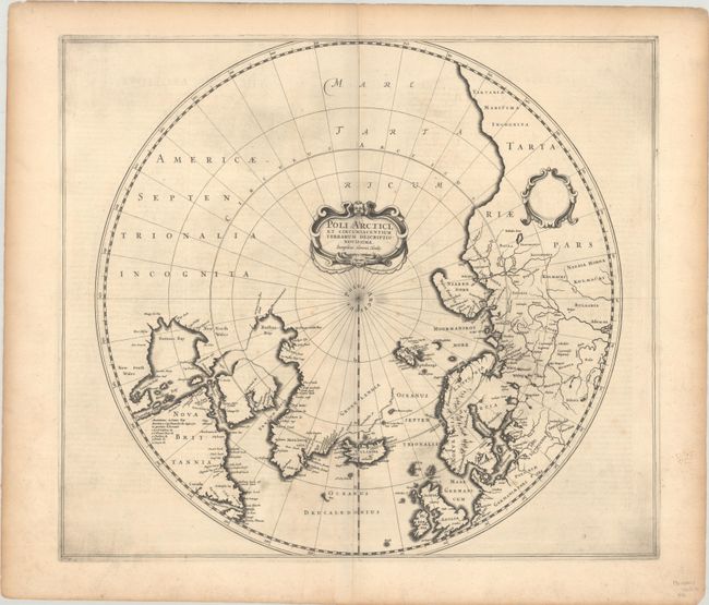
MapMaker: |
Henricus Hondius
|
|
| |
| |
Subject: |
North Pole |
|
| |
Period/Size: |
1636 / 17.0" x 19.5" (43.2 x 49.6 cm)
|
|
| |
Color: |
Black & White
|
|
| |
Condition: |
(B+) A dark impression on a strong, watermarked sheet with just a few spots of light foxing in the image and toning and soiling confined to the edges of the sheet. (condition help) |
|
| |
Source: |
A Geographicke Description of the Regions, Countries and Kingdomes of the World. |
|
| |
References: |
Burden #246; Kershaw #97; Van der Krogt (Vol. I) #0020:1B.. |
|
| |
|
|
| Sales Information |
| |
| |
Price: |
|
|
| |
| |
Offered by: |
Old World Auctions |
|
| |
Catalog: |
Auction No. 193 - Antique Maps, Charts, Atlases & Globes (9567) |
|
| |
Lot/Item #: |
46 |
|
| |
| |
Date: |
07/2023
|
|
| |
| |
|