| Item Detail |
| |
| |
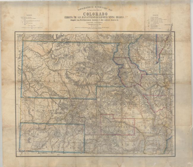
MapMaker: |
Louis Nell
|
|
| |
| |
Subject: |
Colorado |
|
| |
Period/Size: |
1880 / 21.6" x 25.9" (54.9 x 65.8 cm)
|
|
| |
Color: |
Colored
|
|
| |
Condition: |
(B) Issued folding and now flat with moderate staining and soiling. There are a number of splits at the fold junctions with moderate loss at four fold junctions (most notably around Canon City) that have been professionally repaired with image replaced i (condition help) |
|
| |
Source: |
|
|
| |
References: |
|
|
| |
|
|
| Sales Information |
| |
| |
Price: |
|
|
| |
| |
Offered by: |
Old World Auctions |
|
| |
Catalog: |
Auction No. 193 - Antique Maps, Charts, Atlases & Globes (9567) |
|
| |
Lot/Item #: |
240 |
|
| |
| |
Date: |
07/2023
|
|
| |
| |
|