| Item Detail |
| |
| |
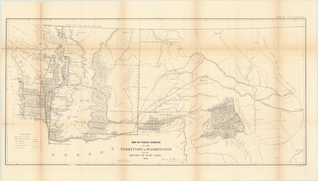
MapMaker: |
General Land Office
|
|
| |
| |
Subject: |
Northwestern United States |
|
| |
Period/Size: |
1862 / 17.1" x 35.1" (43.5 x 89.2 cm)
|
|
| |
Color: |
Black & White
|
|
| |
Condition: |
(B) Issued folding with light toning along the folds. There are several fold separations at left that have been repaired with archival tissue on verso with small loss at two fold junctions. (condition help) |
|
| |
Source: |
H.R. Doc. No. 1, 37th Congress, 3rd Session |
|
| |
References: |
|
|
| |
|
|
| Sales Information |
| |
| |
Price: |
|
|
| |
| |
Offered by: |
Old World Auctions |
|
| |
Catalog: |
Auction No. 193 - Antique Maps, Charts, Atlases & Globes (9567) |
|
| |
Lot/Item #: |
213 |
|
| |
| |
Date: |
07/2023
|
|
| |
| |
|