| Item Detail |
| |
| |
MapMaker: |
Abraham Ortelius
|
|
| |
| |
Subject: |
Holy Land |
|
| |
Period/Size: |
1584 / 18.0" x 13.4" (45.8 x 34.0 cm)
|
|
| |
Color: |
Colored
|
|
| |
Condition: |
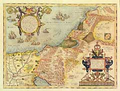
Very light soiling in the margins and in the Mediterranean Sea. A very minute pair of pinholes along the centerfold have been repaired on the back, otherwise fine condition. Two decorative cartouches, one at the bottom right, the other at the top left. (condition help) |
|
| |
Source: |
|
|
| |
References: |
Laor: Maps of the Holy Land: #540B. |
|
| |
|
|
| Sales Information |
| |
| |
Price: |
|
|
| |
| |
Offered by: |
Heritage Map Museum |
|
| |
Catalog: |
16th to 19th Century Rare Map & Book Auction: VIII - June 14, 1997 (8988) |
|
| |
Lot/Item #: |
125 |
|
| |
| |
Date: |
06/1997
|
|
| |
| |
|