Title:
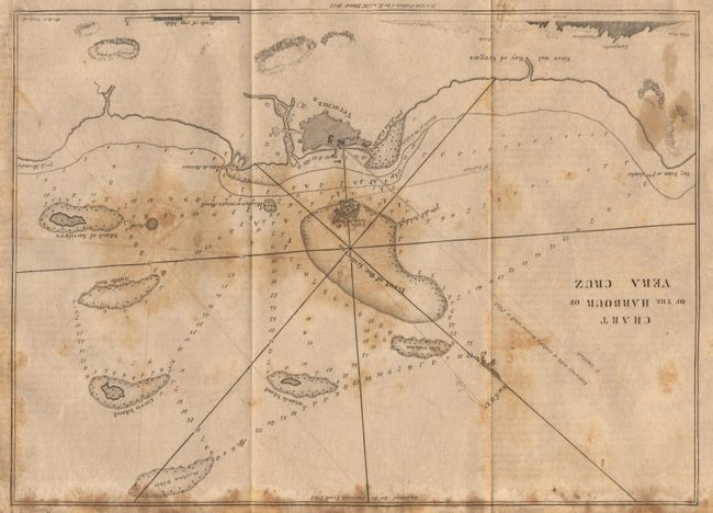
“Chart of the Harbour of Vera Cruz”
Map Maker:
Blunt [Family]
Locates reefs, shoals, and soundings. The fortifi... (full text available to subscribers)
| Item Detail |
| |
| |
MapMaker: |
Blunt [Family]
|
|
| |
| |
Subject: |
Mexico & Virgin Islands |
|
| |
Period/Size: |
1827 / 8.0" x 11.0" (20.4 x 28.0 cm)
|
|
| |
Color: |
Black & White
|
|
| |
Condition: |
(C) Heavily foxed with some staining and offsetting. (condition help) |
|
| |
Source: |
American Coast Pilot |
|
| |
References: |
|
|
| |
|
|
| Sales Information |
| |
| |
Price: |
|
|
| |
| |
Offered by: |
Old World Auctions |
|
| |
Catalog: |
Auction No. 98 - Antique Maps, Charts, Atlases & Globes (303) |
|
| |
Lot/Item #: |
227 |
|
| |
| |
Date: |
03/2002
|
|
| |
| |
|
Antique Maps - Valuation and Pricing, Descriptions, Resources |
|
Home |
Information |
Search |
Register |
Contact Us |
Site Map
Americana Exchange, Inc. © 1999 - 2024 Americana Exchange, Inc.. All rights reserved.
OldMaps.com, the OldMaps.com logo and
AMPR are service marks or registered service marks of Americana Exchange, Inc..
|