Title:
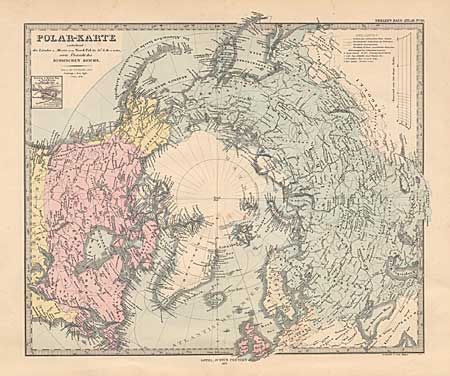
“Polar-Karte enthaltend: die Lander u. Meere vom Nord-Pol bis die 50 N. Br. u. weiter”
Map Maker:
Perthes [Family and Companies]
Details the polar explorations and discoveries to ... (full text available to subscribers)
| Item Detail |
| |
| |
MapMaker: |
Perthes [Family and Companies]
|
|
| |
| |
Subject: |
North Pole |
|
| |
Period/Size: |
1877 / 12.5" x 15.1" (31.8 x 38.4 cm)
|
|
| |
Color: |
Colored
|
|
| |
Condition: |
(B) Fine steel engraving with full hand coloring. Two spots at center, else very good. (condition help) |
|
| |
Source: |
Stieler's Hand-Atlas |
|
| |
References: |
|
|
| |
|
|
| Sales Information |
| |
| |
Price: |
|
|
| |
| |
Offered by: |
Old World Auctions |
|
| |
Catalog: |
Auction No. 98 - Antique Maps, Charts, Atlases & Globes (303) |
|
| |
Lot/Item #: |
035 |
|
| |
| |
Date: |
03/2002
|
|
| |
| |
|
Antique Maps - Valuation and Pricing, Descriptions, Resources |
|
Home |
Information |
Search |
Register |
Contact Us |
Site Map
Americana Exchange, Inc. © 1999 - 2024 Americana Exchange, Inc.. All rights reserved.
OldMaps.com, the OldMaps.com logo and
AMPR are service marks or registered service marks of Americana Exchange, Inc..
|