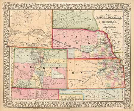
Title:
“Map of Kansas, Nebraska and Colorado showing also the Southern portion of Dacotah”
Map Maker:
Samuel Augustus Mitchell
This map details Kansas, Nebraska and Colorado and... (full text available to subscribers)
| Item Detail |
| |
| |
MapMaker: |
Samuel Augustus Mitchell
|
|
| |
| |
Subject: |
Central United States |
|
| |
Period/Size: |
1867 / 11.5" x 14.0" (29.3 x 35.6 cm)
|
|
| |
Color: |
Colored
|
|
| |
Condition: |
(B) Tear at left just entering border. (condition help) |
|
| |
Source: |
|
|
| |
References: |
|
|
| |
|
|
| Sales Information |
| |
| |
Price: |
|
|
| |
| |
Offered by: |
Old World Auctions |
|
| |
Catalog: |
Auction No. 98 - Antique Maps, Charts, Atlases & Globes (303) |
|
| |
Lot/Item #: |
131 |
|
| |
| |
Date: |
03/2002
|
|
| |
| |
|
Antique Maps - Valuation and Pricing, Descriptions, Resources |
|
Home |
Information |
Search |
Register |
Contact Us |
Site Map
Americana Exchange, Inc. © 1999 - 2024 Americana Exchange, Inc.. All rights reserved.
OldMaps.com, the OldMaps.com logo and
AMPR are service marks or registered service marks of Americana Exchange, Inc..
|