Title:
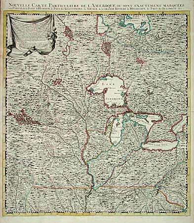
“Nouvelle Carte Particuliere de l' Amerique, ou sont Exactement Marquees, une Partie de la Bay d' Hudson, le Pays des Kilistonons, la Source de la Grande Riviere de Mississipi, le Pays des Illinois &c.”
Map Maker:
Henry Popple
This is the northwest sheet of the Dutch, four-par... (full text available to subscribers)
| Item Detail |
| |
| |
MapMaker: |
Henry Popple
|
|
| |
| |
Subject: |
Colonial North America |
|
| |
Period/Size: |
1741 / 22.5" x 20.5" (57.2 x 52.1 cm)
|
|
| |
Color: |
Colored
|
|
| |
Condition: |
(A) Superb impression with archival tape repairs of minor splits on centerfold, else fine. (condition help) |
|
| |
Source: |
|
|
| |
References: |
|
|
| |
|
|
| Sales Information |
| |
| |
Price: |
|
|
| |
| |
Offered by: |
Old World Auctions |
|
| |
Catalog: |
Auction No. 98 - Antique Maps, Charts, Atlases & Globes (303) |
|
| |
Lot/Item #: |
087 |
|
| |
| |
Date: |
03/2002
|
|
| |
| |
|
Antique Maps - Valuation and Pricing, Descriptions, Resources |
|
Home |
Information |
Search |
Register |
Contact Us |
Site Map
Americana Exchange, Inc. © 1999 - 2024 Americana Exchange, Inc.. All rights reserved.
OldMaps.com, the OldMaps.com logo and
AMPR are service marks or registered service marks of Americana Exchange, Inc..
|