Title:
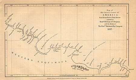
“Map of the Arctic Coast of America from return Reef to Point Barrow explored by Mess.rs P.W. Dease & T. Simpson under the direction of the Hon.ble Hudson's Bay Company”
Map Maker:
Royal Geographical Society
Interesting little map showing these Arctic explor... (full text available to subscribers)
| Item Detail |
| |
| |
MapMaker: |
Royal Geographical Society
|
|
| |
| |
Subject: |
Canada and Alaska |
|
| |
Period/Size: |
1838 / 4.5" x 7.8" (11.5 x 19.9 cm)
|
|
| |
Color: |
Black & White
|
|
| |
Condition: |
(B) Couple of tiny pinholes. (condition help) |
|
| |
Source: |
|
|
| |
References: |
Falk #1838-2; Verner, #60. |
|
| |
|
|
| Sales Information |
| |
| |
Price: |
|
|
| |
| |
Offered by: |
Old World Auctions |
|
| |
Catalog: |
Auction No. 98 - Antique Maps, Charts, Atlases & Globes (303) |
|
| |
Lot/Item #: |
117 |
|
| |
| |
Date: |
03/2002
|
|
| |
| |
|
Antique Maps - Valuation and Pricing, Descriptions, Resources |
|
Home |
Information |
Search |
Register |
Contact Us |
Site Map
Americana Exchange, Inc. © 1999 - 2024 Americana Exchange, Inc.. All rights reserved.
OldMaps.com, the OldMaps.com logo and
AMPR are service marks or registered service marks of Americana Exchange, Inc..
|