Title:
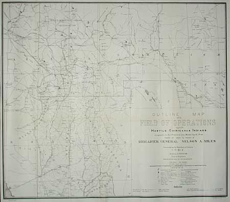
“Outline map of the Field of Operations against Hostile Chiricahua Indians showing operations from April 12th 1886 the date of their Surrender September 4th 1886”
Map Maker:
U.S. War Department
Compiled and Drawn by direction of Brigadier Gener... (full text available to subscribers)
| Item Detail |
| |
| |
MapMaker: |
U.S. War Department
|
|
| |
| |
Subject: |
Arizona and New Mexico |
|
| |
Period/Size: |
1886 / 25.2" x 28.8" (64.0 x 73.2 cm)
|
|
| |
Color: |
Black & White
|
|
| |
Condition: |
(A) Backed with Japanese tissue. Very light area of toning, still very good for this map. (condition help) |
|
| |
Source: |
|
|
| |
References: |
|
|
| |
|
|
| Sales Information |
| |
| |
Price: |
|
|
| |
| |
Offered by: |
Old World Auctions |
|
| |
Catalog: |
Auction No. 99 - Antique Maps, Charts, Atlases & Globes (304) |
|
| |
Lot/Item #: |
174 |
|
| |
| |
Date: |
06/2002
|
|
| |
| |
|
Antique Maps - Valuation and Pricing, Descriptions, Resources |
|
Home |
Information |
Search |
Register |
Contact Us |
Site Map
Americana Exchange, Inc. © 1999 - 2024 Americana Exchange, Inc.. All rights reserved.
OldMaps.com, the OldMaps.com logo and
AMPR are service marks or registered service marks of Americana Exchange, Inc..
|