Rister or Sign In to see pricing information


Title:

East Canada and New Brunswick

Map Maker:

John Tallis

East Canada and New Brunswick

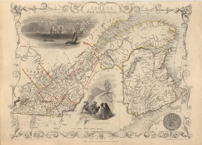
Lovely nineteenth century map of the St. Lawrence ... (full text available to subscribers)
Item Detail
 
  MapMaker:  

John Tallis


  Subject:  Canada  
  Period/Size:  1851 / 10.0" x 12.5"  (25.4 x 31.8 cm)  
  Color:  Colored  
  Condition:  (A) Good impression. Uncolored vignettes, as issued. Closely trimmed at top with slight loss of border above title, as is often the case. (condition help)  
  Source:  Illustrated Atlas  
  References:   
 
 
Sales Information
 
  Price: 

Please register your email to view records, or sign in with email address to see records


  Offered by:  Old World Auctions  
  Catalog:  Auction No. 99 - Antique Maps, Charts, Atlases & Globes (304)  
  Lot/Item #:  138  
 
  Date:  06/2002  


Antique Maps - Valuation and Pricing, Descriptions, Resources


Home | Information | Search | Register | Contact Us | Site Map

Americana Exchange, Inc. © 1999 - 2024 Americana Exchange, Inc.. All rights reserved. OldMaps.com, the OldMaps.com logo and
AMPR are service marks or registered service marks of Americana Exchange, Inc..