| Item Detail |
| |
| |
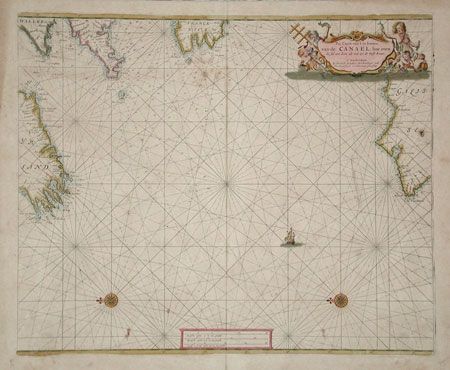
MapMaker: |
Henrick Doncker
|
|
| |
| |
Subject: |
Atlantic |
|
| |
Period/Size: |
1670 / 17.0" x 20.8" (43.2 x 52.9 cm)
|
|
| |
Color: |
Colored
|
|
| |
Condition: |
(B) Lovely original color. Toned with some light foxing. Small burn hole in Spain and two worm tracks at centerfold. Backed with 18th or 19th century paper for additional strength, as is common for sea charts with weakened paper in margins. (condition help) |
|
| |
Source: |
|
|
| |
References: |
|
|
| |
|
|
| Sales Information |
| |
| |
Price: |
|
|
| |
| |
Offered by: |
Old World Auctions |
|
| |
Catalog: |
Auction No. 100 - Antique Maps, Charts, Atlases & Globes (333) |
|
| |
Lot/Item #: |
272 |
|
| |
| |
Date: |
09/2002
|
|
| |
| |
|