Title:
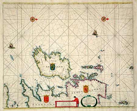
“Paskaarte om Achter Yrlant om te Zeylen, van Hitlant tot aen Heiyssant”
Map Maker:
Henrick Doncker
Sea chart covering all of Ireland and the west coa... (full text available to subscribers)
| Item Detail |
| |
| |
MapMaker: |
Henrick Doncker
|
|
| |
| |
Subject: |
Ireland |
|
| |
Period/Size: |
1670 / 17.2" x 21.2" (43.7 x 53.9 cm)
|
|
| |
Color: |
Colored
|
|
| |
Condition: |
(B) Fine original color. Toned with a few tiny spots. Backed with 18th or 19th century paper for additional strength, as is common for sea charts. (condition help) |
|
| |
Source: |
|
|
| |
References: |
|
|
| |
|
|
| Sales Information |
| |
| |
Price: |
|
|
| |
| |
Offered by: |
Old World Auctions |
|
| |
Catalog: |
Auction No. 100 - Antique Maps, Charts, Atlases & Globes (333) |
|
| |
Lot/Item #: |
305 |
|
| |
| |
Date: |
09/2002
|
|
| |
| |
|
Antique Maps - Valuation and Pricing, Descriptions, Resources |
|
Home |
Information |
Search |
Register |
Contact Us |
Site Map
Americana Exchange, Inc. © 1999 - 2024 Americana Exchange, Inc.. All rights reserved.
OldMaps.com, the OldMaps.com logo and
AMPR are service marks or registered service marks of Americana Exchange, Inc..
|