Title:
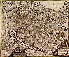
“Holsatiae tabula generalis..”
Map Maker:
Frederick de Wit
Detailed map of the area north of the Elbe. In or... (full text available to subscribers)
| Item Detail |
| |
| |
MapMaker: |
Frederick de Wit
|
|
| |
| |
Subject: |
Germany |
|
| |
Period/Size: |
1690 / 19.8" x 24.1" (50.2 x 61.2 cm)
|
|
| |
Color: |
Colored
|
|
| |
Condition: |
Paper very minor age-toned. (condition help) |
|
| |
Source: |
|
|
| |
References: |
|
|
| |
|
|
| Sales Information |
| |
| |
Price: |
|
|
| |
| |
Offered by: |
Paulus Swaen Old Maps & Prints |
|
| |
Catalog: |
Internet Auction November 2000 (343) |
|
| |
Lot/Item #: |
02422 |
|
| |
| |
Date: |
11/2000
|
|
| |
| |
|
Antique Maps - Valuation and Pricing, Descriptions, Resources |
|
Home |
Information |
Search |
Register |
Contact Us |
Site Map
Americana Exchange, Inc. © 1999 - 2024 Americana Exchange, Inc.. All rights reserved.
OldMaps.com, the OldMaps.com logo and
AMPR are service marks or registered service marks of Americana Exchange, Inc..
|