Title:
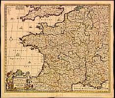
“Accuratissima Galliae Tabula vulgo Royaume de France.”
Map Maker:
Frederick de Wit
Decorative map of France with decorative title car... (full text available to subscribers)
| Item Detail |
| |
| |
MapMaker: |
Frederick de Wit
|
|
| |
| |
Subject: |
France |
|
| |
Period/Size: |
1680 / 19.2" x 22.8" (48.7 x 57.8 cm)
|
|
| |
Color: |
Colored
|
|
| |
Condition: |
In attractive original colours. Split in lower part centre fold, 22cm into engraved area, repaired, hardly notable. (condition help) |
|
| |
Source: |
|
|
| |
References: |
|
|
| |
|
|
| Sales Information |
| |
| |
Price: |
|
|
| |
| |
Offered by: |
Paulus Swaen Old Maps & Prints |
|
| |
Catalog: |
Internet Auction March 2000 (340) |
|
| |
Lot/Item #: |
02055 |
|
| |
| |
Date: |
03/2000
|
|
| |
| |
|
Antique Maps - Valuation and Pricing, Descriptions, Resources |
|
Home |
Information |
Search |
Register |
Contact Us |
Site Map
Americana Exchange, Inc. © 1999 - 2024 Americana Exchange, Inc.. All rights reserved.
OldMaps.com, the OldMaps.com logo and
AMPR are service marks or registered service marks of Americana Exchange, Inc..
|