Title:
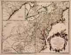
“Partie de l'Amerique septentrionale.. le cours de L'Ohio…”
Map Maker:
Robert de Vaugondy [Family]
A detailed map extending the length of the east co... (full text available to subscribers)
| Item Detail |
| |
| |
MapMaker: |
Robert de Vaugondy [Family]
|
|
| |
| |
Subject: |
Colonial North America |
|
| |
Period/Size: |
1755 / 18.7" x 24.4" (47.5 x 62.0 cm)
|
|
| |
Color: |
Colored
|
|
| |
Condition: |
In good condition. Small brown spot next to title cartouche. (condition help) |
|
| |
Source: |
Atlas Universel |
|
| |
References: |
Pedley, Bel et Utile, 469 (state 1). |
|
| |
|
|
| Sales Information |
| |
| |
Price: |
|
|
| |
| |
Offered by: |
Paulus Swaen Old Maps & Prints |
|
| |
Catalog: |
Internet Auction March 1999 (338) |
|
| |
Lot/Item #: |
02144 |
|
| |
| |
Date: |
03/1999
|
|
| |
| |
|
Antique Maps - Valuation and Pricing, Descriptions, Resources |
|
Home |
Information |
Search |
Register |
Contact Us |
Site Map
Americana Exchange, Inc. © 1999 - 2024 Americana Exchange, Inc.. All rights reserved.
OldMaps.com, the OldMaps.com logo and
AMPR are service marks or registered service marks of Americana Exchange, Inc..
|