Title:
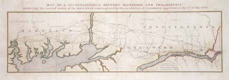
“Map of a Reconnaissance Between Baltimore and Philadelphia exhibiting the several routes of the Mail Road contemplated by the resolution of Congress approved on the 4th of May 1826”
Map Maker:
U.S. Corps of Engineers
Fascinating map issued by S. Bernard, Brigr. Genl.... (full text available to subscribers)
| Item Detail |
| |
| |
MapMaker: |
U.S. Corps of Engineers
|
|
| |
| |
Subject: |
United States - Eastern |
|
| |
Period/Size: |
1827 / 9.0" x 31.0" (22.9 x 78.8 cm)
|
|
| |
Color: |
Colored
|
|
| |
Condition: |
(A) (condition help) |
|
| |
Source: |
HR Doc #94, 19th Cong., 2nd Session |
|
| |
References: |
|
|
| |
|
|
| Sales Information |
| |
| |
Price: |
|
|
| |
| |
Offered by: |
Old World Auctions |
|
| |
Catalog: |
Auction No. 101 - Antique Maps, Charts, Atlases & Globes (348) |
|
| |
Lot/Item #: |
130 |
|
| |
| |
Date: |
12/2002
|
|
| |
| |
|
Antique Maps - Valuation and Pricing, Descriptions, Resources |
|
Home |
Information |
Search |
Register |
Contact Us |
Site Map
Americana Exchange, Inc. © 1999 - 2024 Americana Exchange, Inc.. All rights reserved.
OldMaps.com, the OldMaps.com logo and
AMPR are service marks or registered service marks of Americana Exchange, Inc..
|