| Item Detail |
| |
| |
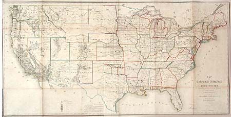
MapMaker: |
General Land Office
|
|
| |
| |
Subject: |
United States |
|
| |
Period/Size: |
1866 / 28.0" x 54.5" (71.2 x 138.5 cm)
|
|
| |
Color: |
Colored
|
|
| |
Condition: |
(B) Backed with linen, as issued, with a couple fold splits, archivally repaired. Light scattered foxing, otherwise very good. (condition help) |
|
| |
Source: |
Annual Report of the Commr. Genl. Land Office |
|
| |
References: |
Wheat (TMW) 1137; Phillips (A) 1388-23. |
|
| |
|
|
| Sales Information |
| |
| |
Price: |
|
|
| |
| |
Offered by: |
Old World Auctions |
|
| |
Catalog: |
Auction No. 102 - Antique Maps, Charts, Atlases & Globes (349) |
|
| |
Lot/Item #: |
139 |
|
| |
| |
Date: |
03/2003
|
|
| |
| |
|