Title:
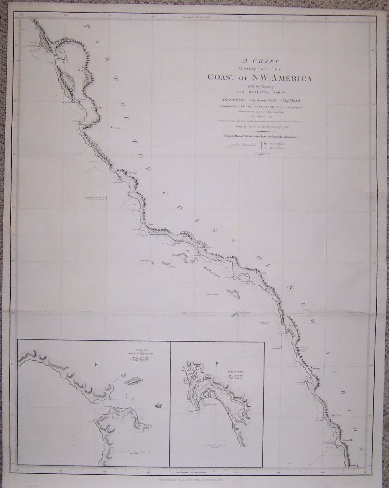
“A Chart Shewing part of the Coast of N.W. America, with the tracks of His Majesty's Sloop Discovery and armed tender Chatham, Commanded by George Vancouver Esq...
Baker”
Map Maker:
George Vancouver
Title continues: "and prepared under his immediate... (full text available to subscribers)
| Item Detail |
| |
| |
MapMaker: |
George Vancouver
|
|
| |
| |
Subject: |
Colonial North America |
|
| |
Period/Size: |
1798 / 31.0" x 24.5" (78.8 x 62.3 cm)
|
|
| |
Color: |
Black & White
|
|
| |
Condition: |
This map has been professionally deacidified, flattened, and lined with a sturdy Japanese paper. (condition help) |
|
| |
Source: |
|
|
| |
References: |
Wagner p209, Howes V23, Storm 4456, Streeter 3497 |
|
| |
|
|
| Sales Information |
| |
| |
Price: |
|
|
| |
| |
Offered by: |
Deja View Antique Maps and Prints |
|
| |
Catalog: |
Web Offerings - August 2003 (356) |
|
| |
Lot/Item #: |
|
|
| |
| |
Date: |
08/2003
|
|
| |
| |
|
Antique Maps - Valuation and Pricing, Descriptions, Resources |
|
Home |
Information |
Search |
Register |
Contact Us |
Site Map
Americana Exchange, Inc. © 1999 - 2024 Americana Exchange, Inc.. All rights reserved.
OldMaps.com, the OldMaps.com logo and
AMPR are service marks or registered service marks of Americana Exchange, Inc..
|