Title:
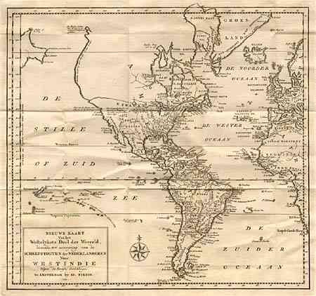
“Nieuwe Kaart van het Westelykste Deel der Weereld, dienende tot aanwyzing van de Scheepstogten der Nederlanderen Naar Westindie…”
Map Maker:
Isaac Tirion
This nice map of the Americas also includes a good... (full text available to subscribers)
| Item Detail |
| |
| |
MapMaker: |
Isaac Tirion
|
|
| |
| |
Subject: |
Western Hemisphere |
|
| |
Period/Size: |
1754 / 13.5" x 14.2" (34.3 x 36.1 cm)
|
|
| |
Color: |
Black & White
|
|
| |
Condition: |
(A+) Fine crisp impression. Folding as issued. (condition help) |
|
| |
Source: |
|
|
| |
References: |
|
|
| |
|
|
| Sales Information |
| |
| |
Price: |
|
|
| |
| |
Offered by: |
Old World Auctions |
|
| |
Catalog: |
Auction No. 103 - Antique Maps, Charts, Atlases & Globes (350) |
|
| |
Lot/Item #: |
074 |
|
| |
| |
Date: |
06/2003
|
|
| |
| |
|
Antique Maps - Valuation and Pricing, Descriptions, Resources |
|
Home |
Information |
Search |
Register |
Contact Us |
Site Map
Americana Exchange, Inc. © 1999 - 2024 Americana Exchange, Inc.. All rights reserved.
OldMaps.com, the OldMaps.com logo and
AMPR are service marks or registered service marks of Americana Exchange, Inc..
|