| Item Detail |
| |
| |
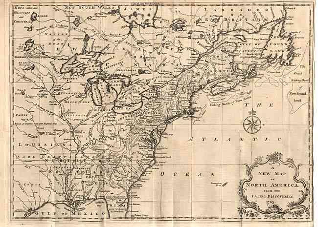
MapMaker: |
John Spilsbury
|
|
| |
| |
Subject: |
Colonial North America |
|
| |
Period/Size: |
1763 / 10.9" x 14.9" (27.7 x 37.9 cm)
|
|
| |
Color: |
Black & White
|
|
| |
Condition: |
(B) Folding as issued. Close trimmed margin on right, nearly to neatline, with a tiny binding tear just entering border. Evenly toned, with a few light spots of foxing. (condition help) |
|
| |
Source: |
London Magazine |
|
| |
References: |
Jolly, LOND-222; Sellers & Van Ee 106; McCorkle 763.7. |
|
| |
|
|
| Sales Information |
| |
| |
Price: |
|
|
| |
| |
Offered by: |
Old World Auctions |
|
| |
Catalog: |
Auction No. 103 - Antique Maps, Charts, Atlases & Globes (350) |
|
| |
Lot/Item #: |
089 |
|
| |
| |
Date: |
06/2003
|
|
| |
| |
|