Title:
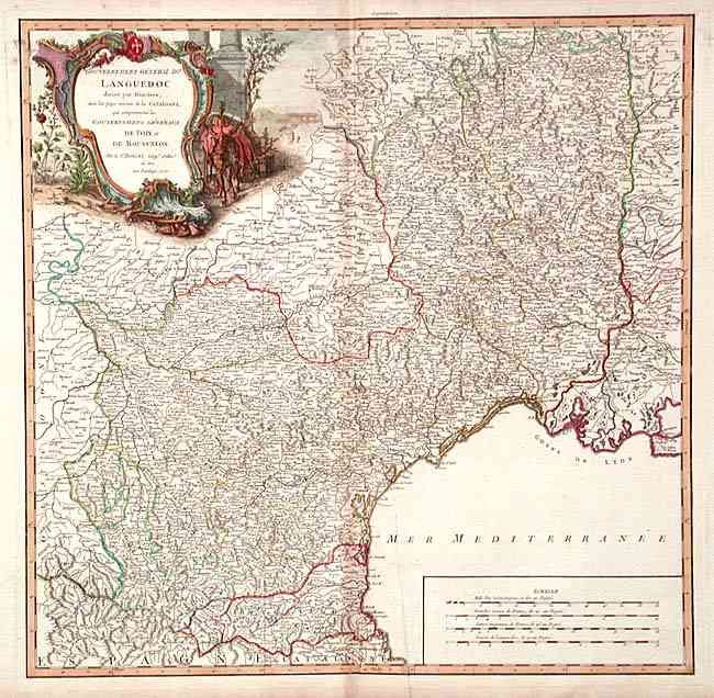
“Gouvernement General du Languedoc divise par Dioceses, avec les pays voisins de la Catalogne…”
Map Maker:
Gilles Robert de Vaugondy
Detailed map of the Languedoc region decorated wit... (full text available to subscribers)
| Item Detail |
| |
| |
MapMaker: |
Gilles Robert de Vaugondy
|
|
| |
| |
Subject: |
France |
|
| |
Period/Size: |
1752 / 18.7" x 19.2" (47.5 x 48.8 cm)
|
|
| |
Color: |
Colored
|
|
| |
Condition: |
(B) Toned on centerfold. Tear at bottom entering map 1/2", closed with archival tape. Printer's crease at right of fold. (condition help) |
|
| |
Source: |
|
|
| |
References: |
Pedley #155. |
|
| |
|
|
| Sales Information |
| |
| |
Price: |
|
|
| |
| |
Offered by: |
Old World Auctions |
|
| |
Catalog: |
Auction No. 103 - Antique Maps, Charts, Atlases & Globes (350) |
|
| |
Lot/Item #: |
366 |
|
| |
| |
Date: |
06/2003
|
|
| |
| |
|
Antique Maps - Valuation and Pricing, Descriptions, Resources |
|
Home |
Information |
Search |
Register |
Contact Us |
Site Map
Americana Exchange, Inc. © 1999 - 2024 Americana Exchange, Inc.. All rights reserved.
OldMaps.com, the OldMaps.com logo and
AMPR are service marks or registered service marks of Americana Exchange, Inc..
|