| Item Detail |
| |
| |
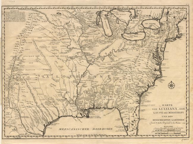
MapMaker: |
Jacques Nicolas Bellin
|
|
| |
| |
Subject: |
Colonial North America |
|
| |
Period/Size: |
1744 / 15.5" x 22.0" (39.4 x 55.9 cm)
|
|
| |
Color: |
Black & White
|
|
| |
Condition: |
(B) Good, crisp impression, minor damp stain on right side just into image. Hinge remnants on verso. Close margin, as issued, with 1/8 inch closed tear just touching neatline. Folding as issued. (condition help) |
|
| |
Source: |
Reisen zu Wasser und zu Lande |
|
| |
References: |
cf. McCorkle 744-1; Brown (Ohio) pp. 69-70. |
|
| |
|
|
| Sales Information |
| |
| |
Price: |
|
|
| |
| |
Offered by: |
Old World Auctions |
|
| |
Catalog: |
Auction No. 103 - Antique Maps, Charts, Atlases & Globes (350) |
|
| |
Lot/Item #: |
086 |
|
| |
| |
Date: |
06/2003
|
|
| |
| |
|