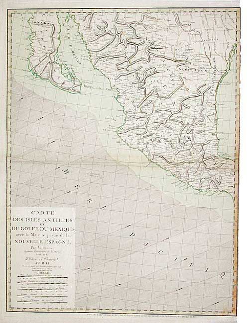
Title:
“Carte des Isles Antilles et du Golfe du Mexique; avec la Majeure partie de la Nouvelle Espangne...”
Map Maker:
Rigobert Bonne
Western sheet only (does not include the Antilles)... (full text available to subscribers)
| Item Detail |
| |
| |
MapMaker: |
Rigobert Bonne
|
|
| |
| |
Subject: |
Western Mexico |
|
| |
Period/Size: |
1780 / 25.6" x 19.5" (65.1 x 49.6 cm)
|
|
| |
Color: |
Colored
|
|
| |
Condition: |
(B) Light scattered foxing and a little weakening on verso of centerfold with old repair, else very good. (condition help) |
|
| |
Source: |
|
|
| |
References: |
|
|
| |
|
|
| Sales Information |
| |
| |
Price: |
|
|
| |
| |
Offered by: |
Old World Auctions |
|
| |
Catalog: |
Auction No. 103 - Antique Maps, Charts, Atlases & Globes (350) |
|
| |
Lot/Item #: |
212 |
|
| |
| |
Date: |
06/2003
|
|
| |
| |
|
Antique Maps - Valuation and Pricing, Descriptions, Resources |
|
Home |
Information |
Search |
Register |
Contact Us |
Site Map
Americana Exchange, Inc. © 1999 - 2024 Americana Exchange, Inc.. All rights reserved.
OldMaps.com, the OldMaps.com logo and
AMPR are service marks or registered service marks of Americana Exchange, Inc..
|