Title:
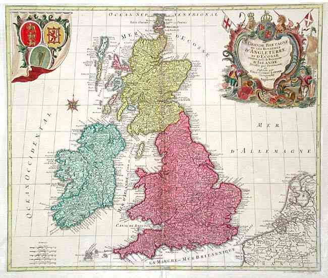
“La Grande Bretagne ou les Royaumes d' Angleterre et d' Ecosse comme aussi le Royaume d' Irlande Divisée par Provinces et Publiee”
Map Maker:
Tobias Conrad Lotter
Copper-engraved map of the British Isles, with coa... (full text available to subscribers)
| Item Detail |
| |
| |
MapMaker: |
Tobias Conrad Lotter
|
|
| |
| |
Subject: |
Britain |
|
| |
Period/Size: |
1772 / 19.2" x 22.7" (48.8 x 57.7 cm)
|
|
| |
Color: |
Colored
|
|
| |
Condition: |
(B) Good impression and original color on thick paper with large anchor watermark. Separation into map at lower centerfold with old repair on verso and two tiny worm holes in ocean top left of centerfold, else very good. (condition help) |
|
| |
Source: |
|
|
| |
References: |
Phillips (A) 3513-11. |
|
| |
|
|
| Sales Information |
| |
| |
Price: |
|
|
| |
| |
Offered by: |
Old World Auctions |
|
| |
Catalog: |
Auction No. 103 - Antique Maps, Charts, Atlases & Globes (350) |
|
| |
Lot/Item #: |
303 |
|
| |
| |
Date: |
06/2003
|
|
| |
| |
|
Antique Maps - Valuation and Pricing, Descriptions, Resources |
|
Home |
Information |
Search |
Register |
Contact Us |
Site Map
Americana Exchange, Inc. © 1999 - 2024 Americana Exchange, Inc.. All rights reserved.
OldMaps.com, the OldMaps.com logo and
AMPR are service marks or registered service marks of Americana Exchange, Inc..
|