Title:
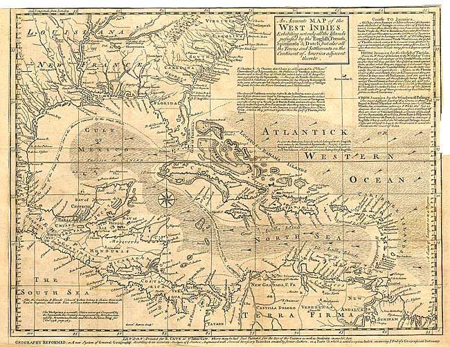
“An Accurate Map of the West Indies Exhibiting not only all the Islands possess'd by the English, French, Spaniards, & Dutch, but also all the Towns and Settlements on the Continent of America adjacent thereto.”
Map Maker:
Thomas Bowen
Fascinating map covering the Southern U.S., Centra... (full text available to subscribers)
| Item Detail |
| |
| |
MapMaker: |
Thomas Bowen
|
|
| |
| |
Subject: |
Gulf of Mexico and Caribbean |
|
| |
Period/Size: |
1740 / 12.2" x 15.2" (31.0 x 38.6 cm)
|
|
| |
Color: |
Black & White
|
|
| |
Condition: |
(C) Dark impression on thick paper. Close trimmed at top, as issued. Binding side trim into neatline and 2" closed tear. Long split along fold, closed on verso, else good. (condition help) |
|
| |
Source: |
Gentleman's Magazine |
|
| |
References: |
Jolly GENT-6. |
|
| |
|
|
| Sales Information |
| |
| |
Price: |
|
|
| |
| |
Offered by: |
Old World Auctions |
|
| |
Catalog: |
Auction No. 104 - Antique Maps, Charts, Atlases & Globes (351) |
|
| |
Lot/Item #: |
270 |
|
| |
| |
Date: |
09/2003
|
|
| |
| |
|
Antique Maps - Valuation and Pricing, Descriptions, Resources |
|
Home |
Information |
Search |
Register |
Contact Us |
Site Map
Americana Exchange, Inc. © 1999 - 2024 Americana Exchange, Inc.. All rights reserved.
OldMaps.com, the OldMaps.com logo and
AMPR are service marks or registered service marks of Americana Exchange, Inc..
|