Title:
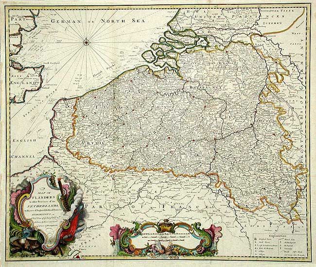
“A Map of Flanders & other Provinces of the Netherlands with part of England, Holland, France, &c., exhibiting a full view of ye Seat of War nth. The Towns & Rivers mentioned in ye Actions & Encampments”
Map Maker:
Claude Dubosc
A large and very decorative map with minute detail... (full text available to subscribers)
| Item Detail |
| |
| |
MapMaker: |
Claude Dubosc
|
|
| |
| |
Subject: |
The Netherlands & Belgium |
|
| |
Period/Size: |
1735 / 19.5" x 23.2" (49.6 x 59.0 cm)
|
|
| |
Color: |
Colored
|
|
| |
Condition: |
(A) Fine impression and coloring. Binding side trim with short repaired tear just into border. Remargined along binding trim. (condition help) |
|
| |
Source: |
Military History |
|
| |
References: |
|
|
| |
|
|
| Sales Information |
| |
| |
Price: |
|
|
| |
| |
Offered by: |
Old World Auctions |
|
| |
Catalog: |
Auction No. 104 - Antique Maps, Charts, Atlases & Globes (351) |
|
| |
Lot/Item #: |
406 |
|
| |
| |
Date: |
09/2003
|
|
| |
| |
|
Antique Maps - Valuation and Pricing, Descriptions, Resources |
|
Home |
Information |
Search |
Register |
Contact Us |
Site Map
Americana Exchange, Inc. © 1999 - 2024 Americana Exchange, Inc.. All rights reserved.
OldMaps.com, the OldMaps.com logo and
AMPR are service marks or registered service marks of Americana Exchange, Inc..
|