Title:
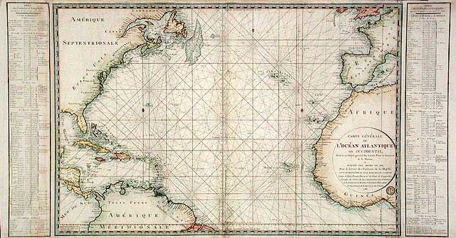
“Carte Generale de l' Ocean Atlantique ou Occidental, Dressee au Depot general des Cartes Plans et Journaux de la Marine…”
Map Maker:
Depot de la Marine
Very large chart of the North Atlantic that shows ... (full text available to subscribers)
| Item Detail |
| |
| |
MapMaker: |
Depot de la Marine
|
|
| |
| |
Subject: |
North Atlantic |
|
| |
Period/Size: |
1786 / 23.6" x 44.0" (60.0 x 111.8 cm)
|
|
| |
Color: |
Colored
|
|
| |
Condition: |
(B) Excellent impression and original color. Small area of damage at lower center with old repair. A few soft folds and scattered soiling. (condition help) |
|
| |
Source: |
|
|
| |
References: |
|
|
| |
|
|
| Sales Information |
| |
| |
Price: |
|
|
| |
| |
Offered by: |
Old World Auctions |
|
| |
Catalog: |
Auction No. 104 - Antique Maps, Charts, Atlases & Globes (351) |
|
| |
Lot/Item #: |
321 |
|
| |
| |
Date: |
09/2003
|
|
| |
| |
|
Antique Maps - Valuation and Pricing, Descriptions, Resources |
|
Home |
Information |
Search |
Register |
Contact Us |
Site Map
Americana Exchange, Inc. © 1999 - 2024 Americana Exchange, Inc.. All rights reserved.
OldMaps.com, the OldMaps.com logo and
AMPR are service marks or registered service marks of Americana Exchange, Inc..
|