Title:
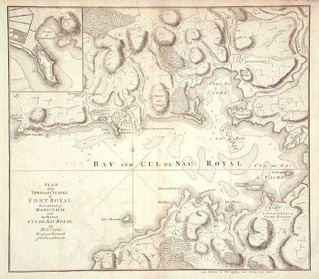
“Plan of the Town and Citadel of Fort Royal the Capital of Martinico with the Bay of Culde Sac Royal”
Map Maker:
Thomas Jefferys
Fully engraved and detailed copper engraved map of... (full text available to subscribers)
| Item Detail |
| |
| |
MapMaker: |
Thomas Jefferys
|
|
| |
| |
Subject: |
Martinique |
|
| |
Period/Size: |
1760 / 12.2" x 14.0" (31.0 x 35.6 cm)
|
|
| |
Color: |
Black & White
|
|
| |
Condition: |
(B) Good impression on hand laid paper with watermark. A little scattered toning and light offsetting. (condition help) |
|
| |
Source: |
|
|
| |
References: |
|
|
| |
|
|
| Sales Information |
| |
| |
Price: |
|
|
| |
| |
Offered by: |
Old World Auctions |
|
| |
Catalog: |
Auction No. 104 - Antique Maps, Charts, Atlases & Globes (351) |
|
| |
Lot/Item #: |
282 |
|
| |
| |
Date: |
09/2003
|
|
| |
| |
|
Antique Maps - Valuation and Pricing, Descriptions, Resources |
|
Home |
Information |
Search |
Register |
Contact Us |
Site Map
Americana Exchange, Inc. © 1999 - 2024 Americana Exchange, Inc.. All rights reserved.
OldMaps.com, the OldMaps.com logo and
AMPR are service marks or registered service marks of Americana Exchange, Inc..
|